Round trip of 13.5 km. No portages.
The Tulpenroute is about 9 km. if you follow the signs.
Kayak rentals:
Nikano kano- en supverhuur, Garden Centre De Veense Bukker, Hazenpad 1, 2371 AA Roelofarendsveen. Tel.: 071-3312673.The polder exists of thick layers of peat. The fields are separated by canals. In the past there was mostly horticulture in this area. Over the years they changed to the cultivation of flowers, nowadays mostly tulips. There are no bulb-fields, but here in the warehouses they grow tulips all year round. So they buy the bulbs from the bulb-growers in the west, and cultivate the flowers for whenever there's a demand. In the northern part of the polder Roelofarendsveen is expanding with the building of luxury homes. It's a pity that the tradional fields are disappearing.
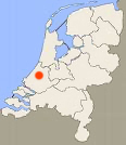
To the starting point Roelofarendsveen
The nearby highway A4 has an exit and onramp only on the eastern side. So if you come from the south you can take exit 5. From the north you pass the town as there's no exit. You exit at exit 6 Leiderdorp. You turn right on the roundabout on the N446 (Provinciale Weg), and at the next roundabout you turn right again on the N445 towards Roelofarendsveen.In Roelofarendsveen you head for the center on the Alkemadelaan. At the third roundabout you turn right on the Stationstraat. After a bridge you turn right at the T-junction on the Westeinde. This is a narrow dead-end road. At the end where it becomes a bike-road you can launch your kayak. There are low sides. There is free parking along the street or in a side-street.
Round trip of 13.5 km.
There is a marked route for small vessels named Tulpenroute (about 9 km). There are signs along the route with information (Dutch only). This route follows mainly the same route.From the starting point you go to the left and follow the bend. You turn right under a bridge and now you're on the Tulpenroute. A sign indicates where to turn left. A little further you take the first canal to the right. Follow the main canal. When a sign of the Tulpenroute indicates to turn left, you go straight on. From here you take the 4th canal to the right. There's no sign. Follow the canal to en end of the polder and at the T-junction you turn left. In the southernmost edge of the polder you follow the bend to the left. At the end of the canal you can turn right to the end of the canal near the dike of the Wijde Aa. Portage is nog possible as this is private ground. You can have a look over the much lower Veenenderpolder. You return the same way. At the junction you go straight on under a bridge. On your left you see a field named "Madeira" (the flower island), where still flowers are cultivated. You go straight on and follow the main canal. From here you follow the Tulpenroute. At a T-junction you turn right towards the locks. This is a nice spot. In the past there was a kayak-route along the ware-houses, but it no longer exists. There is a low liftbridge that you cannot pass without help. So you turn back at the locks and then turn right following the Tulpenroute.
After you crossed a small lake you go under a bridge and then turn right. This is a long straight canal. Take the second canal to the left. Follow the bend to the right and then turn left. Follow the bend to the left and then turn right. When you come at a T-junction you turn right, and then left. Then you turn left and on the lake you turn right passing a small island. Follow the canal between the warehouses. When you come at a lake you turn left and follow the left side into a canal. At a T-junction you can turn right or left. To the right you come at a small lake. On the other side is restaurant "'t Veen". If you go there you return the same way on the canal. Then turn right. Keep going straight on. Follow the bend to the right back to the starting point along the Westeinde.

Downloadable GPS-track 13.5 km: Veenpolder.

Startingpoint at the end of the dead-end road Westeinde.
GPS: N 52.2014 E 4.6192


Near restaurant 't Veen with the watertower in the background.


Veenpolder.

The field named "Madeira".

The adjacent Veenderpolder on the south lies 5 meters below sea-level.

Locks to the Braassemermeer.