

Routes:
Round trip of 27.7 km. (Marneroute) or 24.7 km. passed Wommels and Oosterend. No portages.Kayak rentals
The nearest kayak rental place is Kootje bij de Brug, Wolsumerketting 5, 8774 PK Wolsum, tel.: 0515-569908 of 06-22273586.Campings along the canal
Bolsward: Stadscamping Bolsward.Hichtum: Farm camping Fûgelfrij.
Starting point Bolsward near the Stadscamping.
There is a suitable pier near the Stadscamping, and if it may be occupied there is a low side as well where you can get in.From the A7 you take exit 18 (Bolsward-Oost) and head towards Bolsward. At the roundabout you turn left. After 500 meters you turn right on the Tramweg and then left again. There is free parking at the swimming pool / camping, and there are shops nearby.
Starting point Wommels
There is a pier at the cheese museum. Leave the highway A7 at exit 17 and head north towards Wommels. Exit the N359 towards Wommels. The starting place is on your right just across the bridge. There's a small parking place at the kayak pier next to the museum.Route of 24.7 km.
From the starting point in Bolsward you go to the right. After the iron turnbridge you turn right. At the next intersection you go straight on. Then after 1.8 km you pass the village Burgwerd. Then after 4.0 km. you pass Wommels. There is a kayak pier at the museum It Tsiispakhús on your right. When the canal bends to the right there is a side canal to the left with a sign "Marneroute" on the bridge. Ignore this, it's meant fot those who do the full route of 27.7 km. in the opposite direction. A little further there is a pier on your left. Take the first side-canal to the right. There are many bends and in Oosterend you come at a T-junction. You turn left and pass the church. There is a small pier at the church. You go under the bridge and straight on to the next T-junction. Here you turn left, and then right again. At the next T-junction you turn right, and a little furhter you turn right again. Then follow the main canal to the right and keep on the main canal to Hidaard. There's no pier at Hidaard, and there's nothing special to see. You keep following the main canal Kloostervaart. Near Bolsward you come at the Bolswarder Trekvaart. Here you turn left towards Bolward. At the iron turn-bridge you turn left again.Marneroute 27.7 km
From the starting point in Bolsward you go to the right. After a short distance you turn right again. Then at the next intersection you turn left. Follow the canal passed the new houses to the end. Then at the T-junction you turn right on the Kloostervaart. Follow the main canal to Hidaard. At the T-junction you turn right, and at the next T-jucntion you turn left. At the Y-junction you keep right on the main canal. After the canal make a bend to the right you turn left twice. After the next bend to the right you turn left towards Oosterend. Just follow the main canal. After a bridge you come at a church. There is a small pier for visitors to the church. A little further you turn left. At the next intersection you turn right. On the corner you can go to the side. There are benches. You leave Oosterend and at the end of the canal you turn left at the T-junction. After a bridge you see the industrial area on your left. Here you turn right under the wooden bridge. The Kubaardervaart is narrower and there is alot of vegeation (yellow waterlily). Still it's not difficult to pass. You pass Kubaard and at the end of the village you turn left, and then right again. When you come at the wider Lathumervaart you go straight on. After Kubaard there are no kayak piers, ant the first place where you can go to the side is at the bridge under the N359. There is a passage under the bridge made for ice-skaters when the ice is too thin. You can go to the side here, but it's not so pleasant as cars pass by just over your head. A little further you pass the church of Hichtum. After Hichtum there is a camping along the canal. They have small piers for fishing, no kayak pier. At the next intersection you turn right towards Bolsward. Here you turn left under the iron bridge and straight on you return to the starting point.
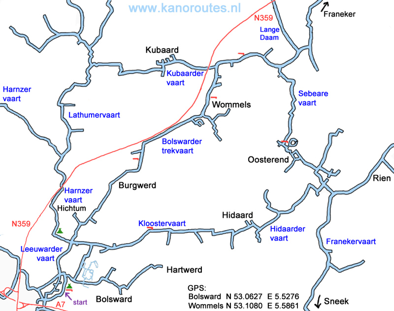
GPS
Stadscamping Bolsward: N 53.0627 E 5.5276
Wommels: N 53.1080 E 5.5861


Downloadable GPS-tracks: Bolsward (24.7 km) and Marneroute Marneroute (27.8 km).

Appelmarkt.

Kerkstraat, Bolsward. The man used to hold a fishing rod with a boot on the line. The rod and the boot have disappeared...


Werkmansbloei, Bolsward.

Turnbridge "Molendraai".

Burgwerd.

Burgwerd.

Bolswarder Trekvaart.

Bolswarder Trekvaart.
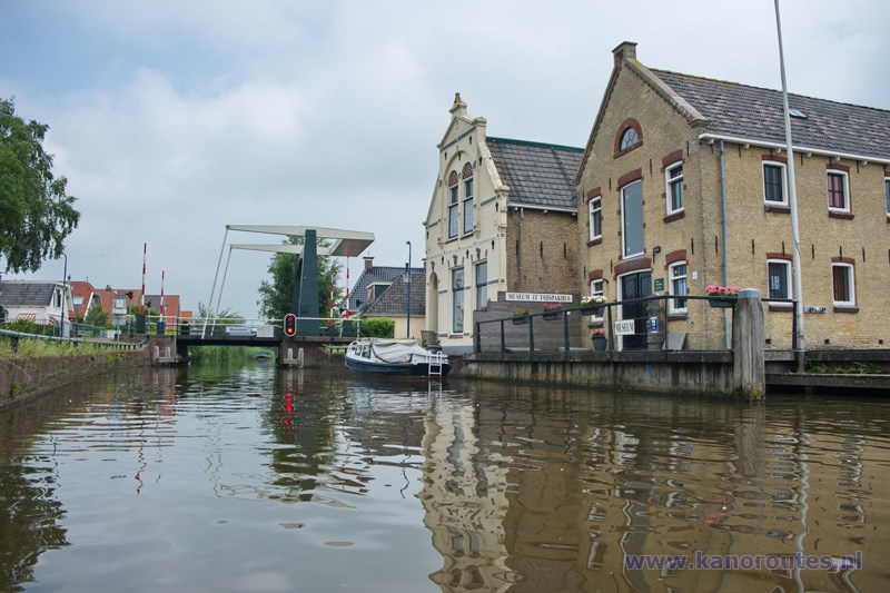
Wommels. Pier at the cheese museum It Tsiispakhús.

Yellow Waterlily in the Hidaardervaart.

Oostereind.

Oostereind.

Kloostervaart.


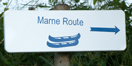 This is a marked route of 27.7 km. A shortcut passed Wommels is 24.7 km.
 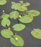 This is the national plant of Friesland.
The leaf (pompeblêd) is shown in the flag.
This is the national plant of Friesland.
The leaf (pompeblêd) is shown in the flag.