

A route of 34 km on the Grecht, Oude Rijn, Ziendevaart and Meije.
You have to pass through the locks 4 times.Passage through the locks is free in Bodegraven and near Zwammerdam, but at Woerdense Verlaat you pay 2 x €1,50 (2021). In Bodegraven portage is not possible, so check operating hours.
I don't know if you have to pay at the locks at Woerdense Verlaat. In the past this was €2,75 at the Kadewetering and €1,40 at th gracht. But that was in a time when you also had to pay in Bodegraven. If anyone knows about the present situation I'd like to know.
Kayak rentals:
No kayak rentals along the route.Starting point Woerdense Verlaat.
Parking space is limited here. You can park at the bridge and locks in the Kadewetering or at the locks in the Grecht. They are 700 meters apart, so you can walk and pick up the car when you return. It saves 2 passages through the locks. It is also possible to pass through the locks.Exit the A2 (Amsterdam - Utrecht) at Breukelen and follow the N401 passing Kockengen. At the roundabout you turn right on the N212. Before a bridge you turn left on the N463 towards Woerdense Verlaat. Just before the bridge you turn left. You can park the car at the houses on your right near the locks. Carry the kayak passed the houses (follow the road) to the kayak pier after the locks.
Starting point near Bodegraven.
On the page about Bodegraven you find information about this starting point opposite the fortress Wierickerschans.From the locks at Woerdense Verlaat you head south on the Grecht. This canal was dug in the 15th century to connect Woerden to the north. The actual plan was to make a straight canal, but local farmers objected as they didn't want there land being devided in two parts. At their own cost they were allowed to dig a canal with many bends around their pastures. The many bends make the canal very attractive for kayaks. It is a very silent canal, there's only a bike-road along it. There are several pieces of nature along the canal with swamps and reedlands, named the Kamerikse Nessen. Most of them are not accessible, but in the south there is ons passage parallel to the main canal that you can navigate. After 8.5 km you come at a T-junction. You can turn left here to visit Woerden, but the main route goes to the right on the Oude Rijn. You head west on the Oude Rijn. This is a wider canal and some boats pass by from time to time. In Nieuwerbrug there is a former toll-bridge. Kayaks can go under the bridge for free. In Bodegraven you have pass locks. Portage is not possible as the sides are rather high. Passage is free. The next village is Zwammerdam. Here you turn right on the Ziende. After a short distance you come at locks. You can carry the kayak passed the locks. After the locks you turn sharp right to the Meije. If you would go straight on you come at the Nieuwkoopse Plassen. Follow the Meije for 9.5 km. Then you follow the bend to the left and you follow the straight canal to the north (direction Noorden). After a short distance you turn right on the main canal towards Woerdense Verlaat. Just before the locks you can go to side on your right. To prevent further portages you better walk 700 meters to the other locks where you left the car and drive back to collect the kayak. You can also pass through the locks. The first one, the Slikkendammersluis is for free, but I don't know about the second one.
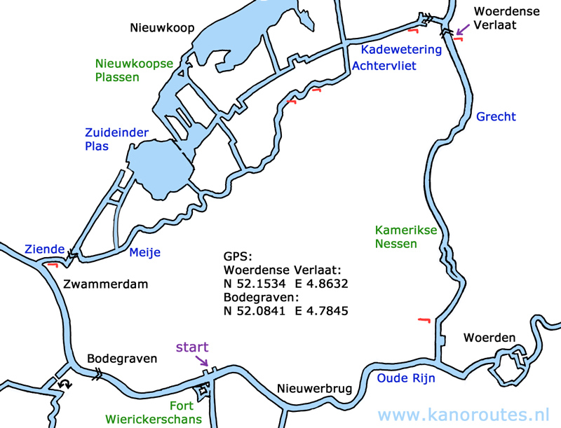
GPS Woerdense Verlaat: Lat. 52.1534, Lon. 4.8632.
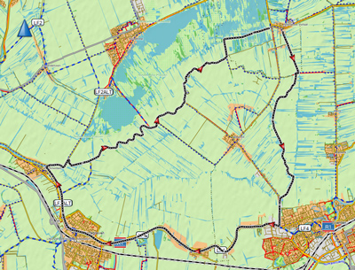
For a more detailed map of the Nieuwkoopse Plassen click
here.
Downloadable GPX track of 33.5 km.: Rijn-Meije. I walked between the locks at Woerdense Verlaat, otherwise the route would be 34 km.

Kamerikse Nessen.

Grecht.

Grecht.

Kamerikse Nessen.

Nieuwerbrug.

Oude Rijn.

Bodegraven.

Bodegraven.

Meije.

Meije.

